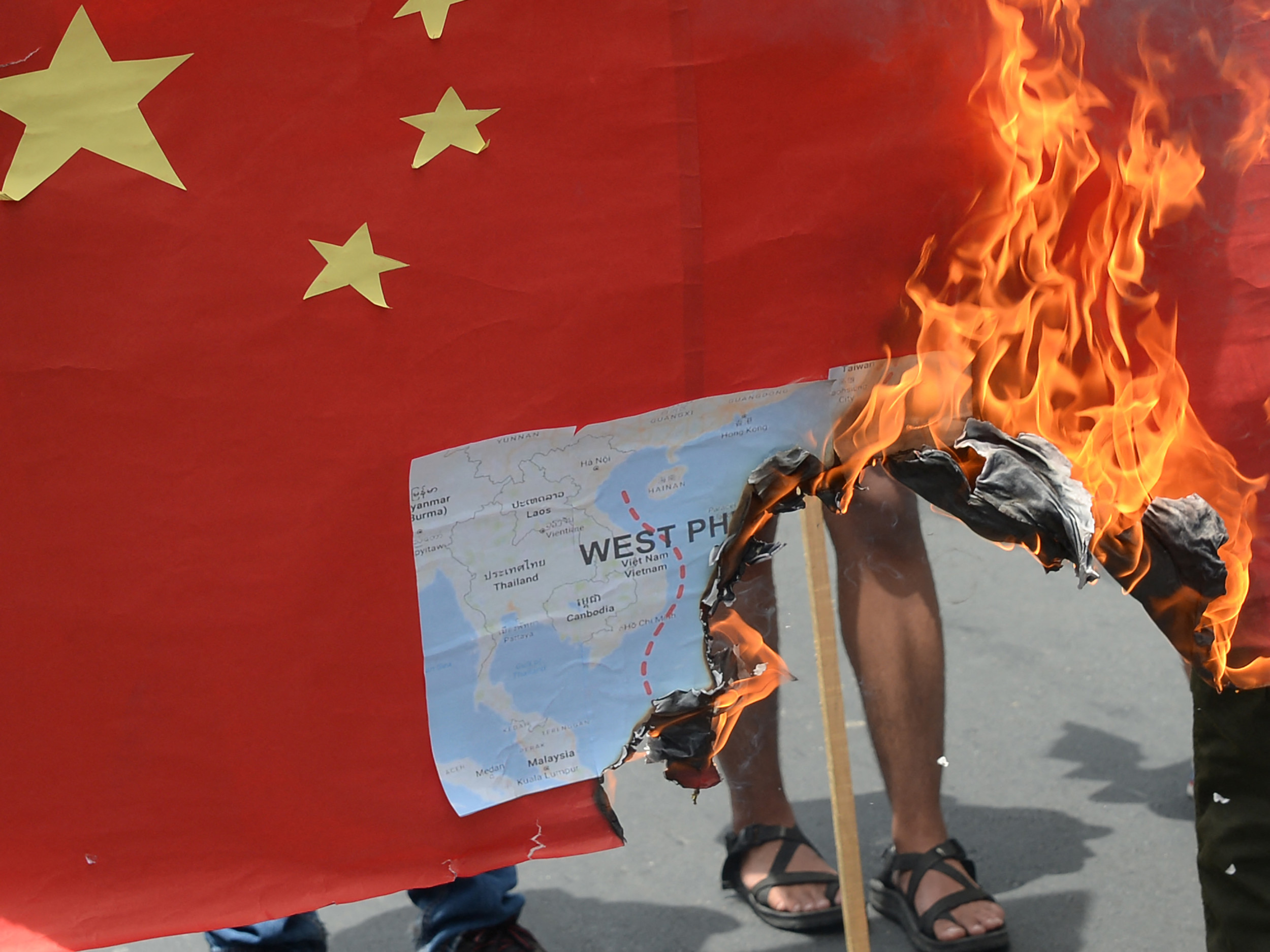
A new map of China’s national borders has sparked protests from governments in Asia after it demarcated the territory of its neighbours, including a small part of Russia.
The map, published by China’s Ministry of Natural Resources on Monday, claims disputed territory on its southern border with India and includes all of Taiwan. Off its southern coast, Beijing’s so-called “dashed line” occupies vast swaths of the South China Sea, where six countries dispute islands, reefs and marine areas.
Beijing’s long-standing territorial claims on its periphery are not new. But under Chinese leader Xi Jinping, China has used its growing hard power to advance its ambitions. In recent years, its neighbors have also faced the heavy presence of the Chinese Coast Guard.
Russia
Moscow and Beijing put aside their centuries-old border disputes for the sake of political stability two decades ago. The last territorial settlement, ratified by the two countries’ parliaments in 2005, resolved the issue of their shared eastern border, which had been under renewed scrutiny due to a Chinese mapping service.
Bolshoi Ussurisky Island, or Hexiazy, is located at the confluence of two border rivers, and ownership is legally shared between the two countries. China’s official map depicts the entire strategic 135-square-mile plot of land in the far east of its territory.
The Kremlin has not yet commented on the map, which Beijing said was compiled using “the national borders of China and different countries in the world.”
The Russian Foreign Ministry did not respond to an email request for comment.
India
Xi Jinping and Indian Prime Minister Narendra Modi met a few days ago, apparently in a friendly manner, at the recent BRICS summit in South Africa, and the controversy surrounding China’s map comes two weeks before they are scheduled to meet again in New Delhi to attend the next G20 forum. .
The Indian government and at least one lawmaker were the first to respond to what they saw as a land grab in the northern Indian state of Arunachal Pradesh, at the eastern end of the disputed 2,100-mile border known as the Line of Actual Control.
Beijing considers the region part of Tibet and announced new Chinese place names there in April. Its map also includes the Aksai Chin region in the west, which is controlled by China and claimed by India.
“Today we have lodged a strong protest through diplomatic channels with the Chinese side over China’s so-called ‘standard map’ for 2023 which claims sovereignty over India’s territory,” Arindam Bagchi, spokesman for the Indian Ministry of External Affairs, said on Wednesday.
“We reject these allegations because they are baseless. Such steps from the Chinese side only complicate the solution of the border issue,” Bagchi said.
Subramaniam Jaishankar, Indian Foreign Minister, described Beijing’s move as an “old habit.” “This government is very clear about what our lands are. Making ridiculous claims does not make other people’s lands yours,” he told India’s NDTV radio.
“India cannot remain a silent spectator to such Chinese activities,” said defense analyst Ashok Kumar, a retired major general from the Indian Armed Forces.
“India must re-strategize to counter such actions in a proactive manner. It would be ironic to host the Chinese Premier as part of the G20 summit when such action is taken just before this meeting,” Kumar said. Newsweek.
South China Sea
“A valid national map is a symbol of national sovereignty and territorial integrity,” Li Yongchun, a senior official with the Ministry of Natural Resources, said of the newly released map, on which 10 dashes can be seen encircling the entire South China Sea.
“Publicity and education on national territorial awareness is an important content of patriotic education and an inseparable part of ideological work in the new era,” Li said. “Maps, text, pictures, and paintings can describe national territory, but maps are the most common and intuitive form of expressing national territory.”
Malaysia was the first country bordering the energy-rich sea to oppose the Chinese map, which claims disputed features and most of the country’s exclusive economic zone. International law recognizes a state’s right to marine resources within its exclusive economic zone, which extends up to 200 nautical miles from the coast.
“Malaysia does not recognize China’s 2023 standard map, which designates parts of Malaysian waters near Sabah and Sarawak as belonging to China,” the Malaysian Foreign Ministry said in a statement. “Malaysia is not bound by China’s 2023 standard map in any way.”
“Malaysia views the South China Sea issue as a complex and sensitive matter. It must be dealt with in a peaceful and rational manner through dialogues and negotiations on the basis of international laws, including UNCLOS.”
The Philippines – which has been repeatedly besieged by Chinese coast guard vessels as it attempts to resupply a Manila-controlled outpost in the Spratly Islands – said its Foreign Affairs Ministry would file a diplomatic protest because the map “violates sovereignty, sovereign rights and territorial integrity.” “This is about the Philippines,” said Jonathan Malaya, assistant director of President Ferdinand Marcos Jr.’s National Security Council.
The Chinese Foreign Ministry said that publishing the map was “a routine exercise in China’s exercise of its sovereignty in accordance with the law.” “We hope that relevant parties will remain objective and calm, and refrain from over-interpreting the issue,” ministry spokesman Wang Wenbin said on Wednesday.
The governments of Brunei, Vietnam and Indonesia did not respond to separate written requests for comment
Taiwan
The inclusion of Taiwan on the Chinese map would have surprised few. Beijing maintains a long-standing claim to the democratically governed island, whose Republic of China government maintains control over Taiwan, as well as a number of outlying island groups, including two off China’s east coast.
Taipei has spent decades rejecting Beijing’s sovereignty claims, but has only recently increased its defense spending to counter China’s expanding military footprint in and around the Taiwan Strait. The geopolitical and geoeconomic ramifications of any move to seize the island by force are not lost on Taiwan’s neighbors or its supporters in the United States.
“The People’s Republic of China has never ruled Taiwan. This is the truth and the status quo universally recognized by the international community,” Jeff Liu, spokesman for Taiwan’s Foreign Ministry, told reporters on Wednesday.
“No matter how the Chinese government distorts its claims to Taiwan’s sovereignty, it cannot change the objective reality of our country’s existence,” Liu said.
Japan
China and its neighbor Japan have a long history of disputes. This week, a renewed war of words broke out in the wake of Beijing’s decision to ban all Japanese seafood products in response to Tokyo’s discharge of diluted wastewater from the Fukushima nuclear plant, which was damaged by the 2011 earthquake and tsunami.
But to the northeast of Taiwan, in the East China Sea, and barely visible on a map of the new China, lies the disputed group of Senkaku Islands, which China calls Diaoyu and which Taiwan claims as Diaoyutai. The uninhabited islands are under Japanese administration and protected by the US Defense Treaty.
The territorial dispute, in which Taipei is now rarely involved due to improved relations with Tokyo, erupted a decade ago when the Japanese government nationalized the islands. Since then, China’s largest maritime law enforcement vessels — some equipped with machine guns — have strengthened Beijing’s claim to the islands by circling them almost daily, often anchoring in their territorial waters for days.
It is just one of several potential flashpoints in Asia involving territorial disputes between China and its neighbors.
Li, the Chinese government official, said Beijing’s new map has a “serious political nature and strict legal nature” as well.

“Coffee trailblazer. Certified pop culture lover. Infuriatingly humble gamer.”


